Planning a construction project or land development in Chitwan? Understanding topographic survey costs is crucial for budgeting your project effectively. This comprehensive guide covers everything you need to know about surveying 28 ropani of land in Chitwan, Nepal, including current market rates, factors affecting costs, and tips to get the best value.
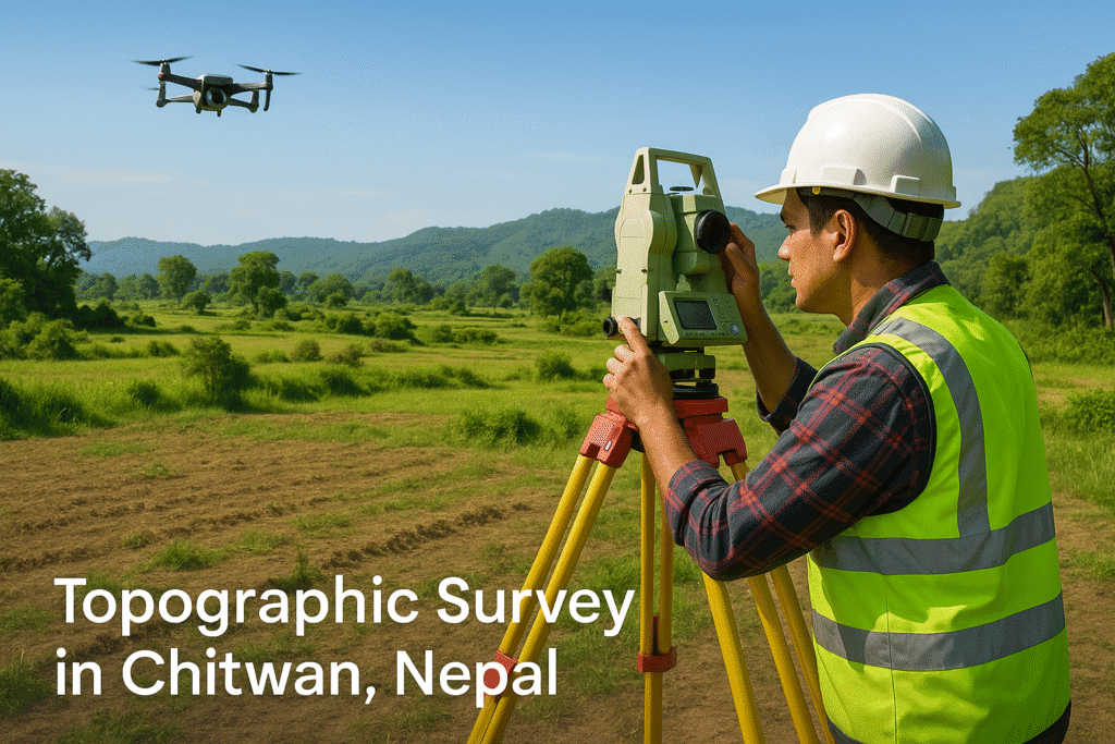
What is a Topographic Survey and Why Do You Need One?

A topographic survey creates detailed maps showing the elevation, contours, and natural features of your land, including:
- Natural features: Hills, streams, trees, and rock formations
- Man-made structures: Buildings, roads, fences, and utilities
- Elevation data: Contour lines and spot heights
- Boundary information: Property lines and corners
In Chitwan’s diverse terrain—from flat Terai plains to undulating hills—topographic surveys are essential for:
- Construction planning and foundation design
- Drainage and irrigation system development
- Land use optimization for agriculture
- Legal documentation and property registration
- Infrastructure development projects
Understanding Land Measurement: 28 Ropani in Context
Nepal’s traditional land measurement system uses ropani as the primary unit in hilly regions:
Key Conversions:
- 1 Ropani = 508.72 square meters = 5,476 square feet
- 28 Ropani = 14,244 square meters ≈ 153,328 square feet ≈ 3.52 acres
- 28 Ropani = 448 Aana (16 Aana = 1 Ropani)
Your 28 ropani plot represents a substantial 3.52-acre property, making it a significant surveying undertaking that requires professional expertise and advanced equipment.
Factors That Determine Topographic Survey Costs in Chitwan
1. Property Size and Complexity
- Large plots like 28 ropani require more time and resources
- Terrain complexity: Flat agricultural land costs less than slopes or forested areas
- Water features: Streams or ponds add complexity and cost
2. Survey Technology and Equipment
- Basic surveys: Total Station and DGPS equipment
- Advanced surveys: Drone mapping and 3D modeling
- GIS integration: Digital mapping and database creation
3. Location and Accessibility
- Urban areas: Better accessibility, lower travel costs
- Remote locations: Additional logistics and transportation fees
- Site conditions: Dense vegetation or difficult terrain increases labor time
4. Surveyor Expertise and Reputation
- Licensed professionals: Higher rates but better accuracy and compliance
- Specialized firms: Premium pricing for advanced services
- Local vs. national companies: Cost variations based on overhead
2025 Cost Breakdown for 28 Ropani Topographic Survey in Chitwan

Base Survey Costs
- Per acre rate: NPR 25,000 – NPR 60,000
- Total for 3.52 acres: NPR 88,000 – NPR 211,200
Additional Cost Factors
Terrain Complexity Surcharge (20-40%)
- Streams, slopes, or dense vegetation: +NPR 17,600 – NPR 84,480
Advanced Technology Options
- Drone aerial mapping: +NPR 25,000 – NPR 60,000
- 3D modeling and visualization: +NPR 15,000 – NPR 40,000
- GIS database creation: +NPR 10,000 – NPR 25,000
Travel and Logistics
- Remote site access: +NPR 5,000 – NPR 20,000
- Multiple site visits: +NPR 3,000 – NPR 10,000
Regulatory Compliance
- National Grid tie-in: +NPR 15,000 – NPR 25,000
- Legal documentation: +NPR 8,000 – NPR 15,000
Total Estimated Investment
Basic Survey: NPR 110,000 – NPR 250,000 Comprehensive Survey with Advanced Features: NPR 180,000 – NPR 400,000
Choosing the Right Surveyor in Chitwan: Key Considerations
Essential Qualifications
- Licensed by Nepal’s Department of Survey
- Experience with large-scale projects (25+ ropani)
- Modern equipment (DGPS, Total Station, drones)
- Strong local reputation and client references
Technology Capabilities
- Digital mapping: CAD and GIS software proficiency
- Drone services: Aerial photography and mapping
- 3D modeling: Advanced visualization capabilities
- Data integration: Compatible with engineering software
Step-by-Step Survey Process: What to Expect
Phase 1: Pre-Survey Preparation (1-2 days)
- Site reconnaissance and access planning
- Review of existing property documents
- Neighbor notification and boundary verification
- Equipment mobilization and team deployment
Phase 2: Field Survey Work (2-4 days)
- Boundary establishment and monumentation
- Topographic data collection using DGPS/Total Station
- Feature identification and mapping
- Aerial photography (if drone services included)
Phase 3: Data Processing and Mapping (3-5 days)
- Survey data processing and quality control
- Topographic map creation with contour lines
- 3D model generation (if requested)
- Digital file preparation in multiple formats
Phase 4: Deliverables and Documentation (1-2 days)
- Final map production and printing
- Digital file delivery (CAD, PDF, GIS formats)
- Survey report with technical specifications
- Legal documentation for land office submission
Cost-Saving Strategies for Your Survey Project
Smart Planning Tips
- Compare multiple quotes from at least 3-4 reputable firms
- Clearly define scope to avoid unnecessary add-on services
- Plan site access to minimize logistics costs
- Bundle services if you need multiple survey types
- Schedule during dry season for better site conditions
Legal and Regulatory Considerations
Government Requirements
- Compliance with Nepal’s National Grid system
- Department of Survey licensing verification
- Local Malpot office documentation standards
- Environmental clearance (if required)
Documentation You’ll Receive
- Detailed topographic maps with contour lines
- Digital survey files (CAD, PDF, GIS formats)
- Survey report with technical specifications
- Legal survey certificate for property registration
- Coordinate data tied to National Grid
Maximizing Value from Your Survey Investment
Long-term Benefits
- Construction planning: Precise elevation data for foundation design
- Drainage solutions: Proper water management planning
- Property value: Documented surveys increase property marketability
- Legal protection: Clear boundary documentation prevents disputes
- Future development: Baseline data for expansion projects
Digital Asset Management
- Request files in multiple formats (CAD, PDF, GIS)
- Ensure compatibility with engineering software
- Archive digital files for future reference
- Share with architects and engineers for project planning
Conclusion: Making an Informed Decision
Investing in a professional topographic survey for your 28 ropani property in Chitwan is a crucial step for successful land development. With costs ranging from NPR 110,000 to NPR 400,000 depending on complexity and technology requirements, proper planning and surveyor selection can help you get the best value for your investment.
Key Takeaways:
- Budget NPR 150,000 – NPR 300,000 for a comprehensive survey
- Choose licensed surveyors with modern equipment
- Clearly define your project requirements upfront
- Request detailed quotes comparing services and deliverables
- Ensure compliance with Nepal’s surveying standards
For accurate quotes tailored to your specific property, contact reputable firms like AS Design to discuss your 28 ropani surveying project in Chitwan.
Need a topographic survey in Chitwan ? Contact licensed surveyors today for competitive quotes and professional service that meets Nepal’s surveying standards.
Disclaimer: Costs are estimates based on 2025 market data and may vary based on specific site conditions, surveyor selection, and project requirements. Always consult multiple licensed surveyors for accurate pricing.