Buying land or starting a construction project in Nepal is a significant investment. But before you lay the first brick or even finalize the deal, there’s one critical step that can save you from future disputes, legal troubles, and costly mistakes: a professional land survey.
Navigating the world of jagga napi (land measurement) can feel complex. What does the process involve? How much should it cost? And what do all those terms on the map even mean?
This guide will walk you through everything you need to know. As a leading design and construction company in Nepal, House Design in Nepal, we’ve seen firsthand how a proper survey provides the foundation for successful projects. Consider this your roadmap to understanding land surveying in Nepal.
Land Surveying in Nepal Basics: What Every Property Owner in Nepal Should Know
At its core, a land survey is the professional process of measuring and mapping a piece of land. A licensed surveyor uses specialized equipment to determine the precise boundaries, dimensions, elevation, and features of your property. The final output is an official map (naksa) and a report that serves as a legal document.
Why is it crucial?
- Preventing Disputes: A clear, legally recognized boundary is the best way to prevent disagreements with neighbors.
- Legal Validation: It’s required for property registration, transfer of ownership (Namsari), and obtaining building permits from the municipality.
- Informed Planning: A detailed survey, especially a topographic one, is essential for architects and engineers to design a house that fits the land perfectly.
- Accurate Valuation: It confirms the exact area of your land, which is a primary factor in its market value.
The Department of Survey is the government body that regulates all survey activities in Nepal, ensuring they are conducted to a professional standard.
The Official Land Survey Process in Nepal (Step-by-Step)
While minor details can vary, the official process for getting your land surveyed follows a standard procedure. If you’re looking for professional land surveying in nepal services, this is the process you can expect:
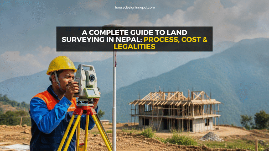
Step 1: Finding a Licensed Surveyor Your first step is to hire a surveyor or a company that is licensed by the Nepal government. This is non-negotiable, as only reports from licensed professionals are legally valid.
Step 2: Initial Consultation & Document Review The surveyor will ask for existing documents like your land ownership certificate (Lal Purja), citizenship, and any previous maps. You’ll discuss the purpose of the survey (e.g., boundary confirmation, new construction, subdivision).
Step 3: Fieldwork and Data Collection This is where the on-site measurement happens. Surveyors use advanced equipment like GPS/GNSS receivers and Total Stations to capture precise data points across your property. They locate boundary markers and map the terrain’s features.
Step 4: Data Processing and Map Creation Back in the office, the raw data from the field is processed using specialized software to create an accurate, scaled drawing of your land.
Step 5: Report Delivery and Submission You receive the final survey map and report. For official purposes like property registration, this map is then submitted to the local Malpot (Land Revenue Office) to update government records.
How to Read a Land Survey Map (Naksa) in Nepal
The official survey map, or naksa, can look intimidating, but it’s easy to understand once you know what to look for.
Key Elements on Your Survey Map
- Plot Number (Kitta Number): This is the unique identification number for your specific parcel of land within the government’s records.
- Scale: The scale (e.g., 1:500) tells you the relationship between the measurements on the map and the actual measurements on the ground.
- North Arrow: This symbol shows the orientation of your property, which is crucial for design and understanding sunlight exposure.
- Boundary Lines and Dimensions: The map shows the exact shape of your property with the length of each side clearly marked.
- Adjacent Plot Details: Your map will also typically show the kitta numbers of neighboring properties.
Understanding these basics helps you verify that the land you are buying is exactly what the documents claim. This section helps you learn how to read a land survey map.
Land Survey Calculations and Measurement Units in Nepal
Nepal famously uses two distinct systems for land measurement, depending on the region. This is where most land survey calculations come into play.
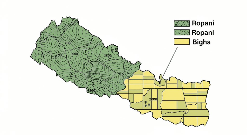
Hilly Region System: Ropani-Aana-Paisa-Dam
This system is standard in Kathmandu Valley and other hilly regions.
- 1 Ropani = 16 Aana
- 1 Aana = 4 Paisa
- 1 Paisa = 4 Dam
- Key Conversion: 1 Ropani = 5476 square feet
Terai Region System: Bigha-Kattha-Dhur
This system is used across the Terai plains.
- 1 Bigha = 20 Kattha
- 1 Kattha = 20 Dhur
- Key Conversion: 1 Bigha = 72900 square feet
Converting between these units can be tricky. For quick and accurate conversions, you can use our free unit conversion calculator.
The Legal Framework: Land Survey and Measurement Act
All land surveying in Nepal is governed by law to ensure consistency and authenticity. The primary legislation is the Land (Survey and Measurement) Act, 2019 B.S. (1963 A.D.). The “2019” in the common long-tail keyword land survey and measurement act 2019 refers to the Bikram Sambat calendar year.
This act empowers the Department of Survey to create and maintain official land records, and it sets the standards that all licensed surveyors must follow. It is the law that makes your survey map a powerful legal document.
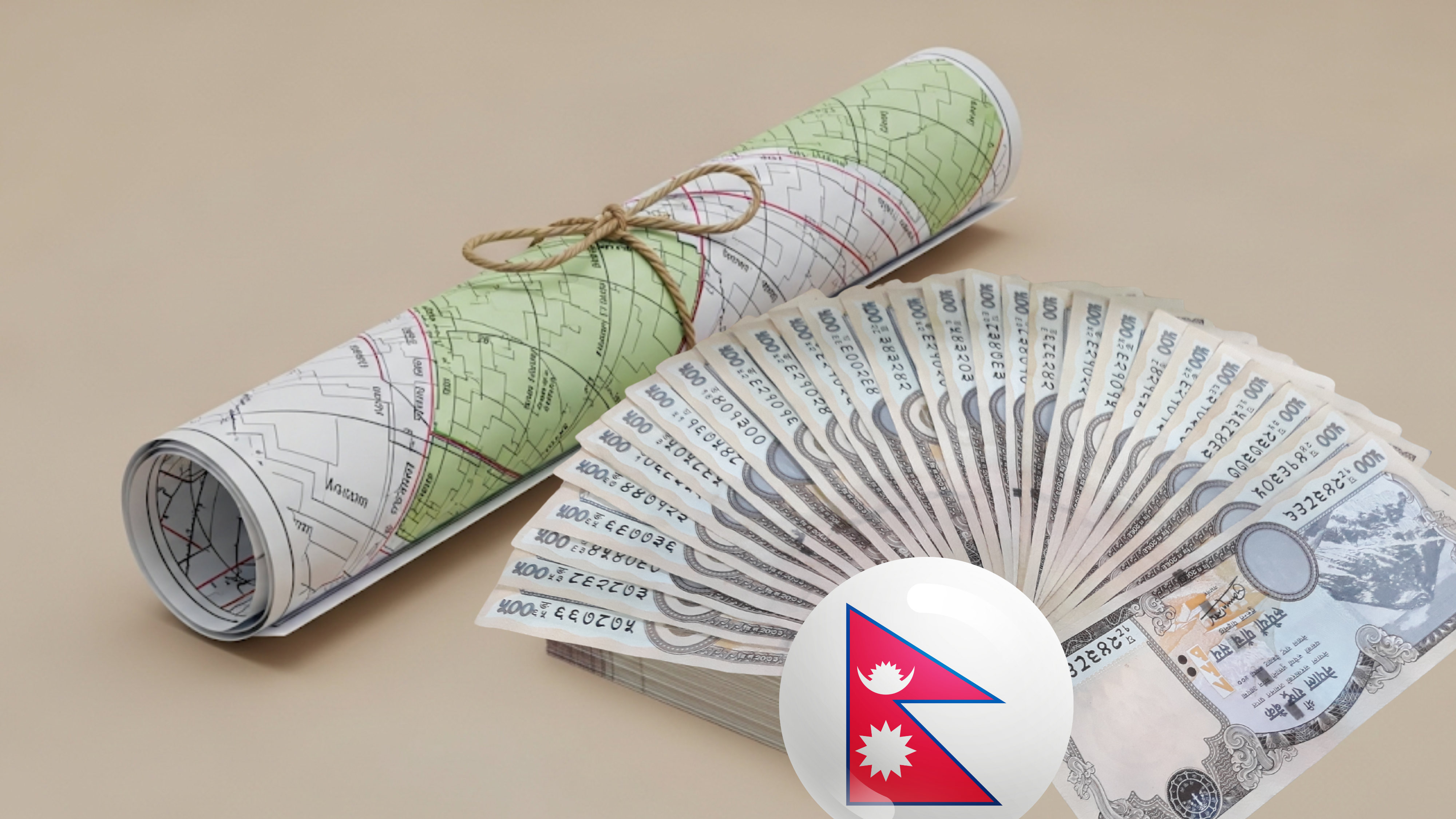
What is the Average Cost of a Land Survey in Nepal?
The average cost of a land survey in Nepal is not fixed; it depends entirely on the scope of work.
Factors That Influence the Final Price
- Property Size and Location: A large plot in a remote, rural area will cost more to survey than a small plot in Kathmandu.
- Terrain Complexity: Surveying a flat piece of land is simpler and cheaper than a steep, difficult-to-access hillside.
- Type of Survey: A simple boundary survey is the most affordable. A detailed topographic survey required for complex construction will cost more.
- Technology Used: Advanced methods like drone surveys can be more expensive upfront but are faster and more accurate for large areas.
Estimated Price Brackets:
- Standard Boundary Survey: NPR 15,000 – NPR 50,000
- Topographic Survey: NPR 80,000 – NPR 200,000+
These prices are estimates. It’s always best to get a detailed quote that covers all comprehensive design and construction services.
Choosing the Right Surveyor for Your Project
Your project’s success starts with reliable data. Here’s how to choose the right professional:
- Check Their License: Ask to see their license from the Department of Survey.
- View Past Work: A reputable company will be happy to show you examples of their work. You can view our past projects to see the level of detail we provide.
- Inquire About Technology: Ask what equipment they use to ensure you’re getting modern, accurate results.
- Seek Clarity on Deliverables: Ensure you know exactly what you will receive (e.g., printed maps, digital files, a detailed report).
A great project often involves a team of experts, from surveyors to architects to professionals like interior designers who bring the final vision to life.
Frequently Asked Questions (FAQs)
Q1: What documents are needed for a land survey in Nepal? A: You will typically need a copy of the land ownership certificate (Lal Purja), the seller/owner’s citizenship certificate, and any existing maps of the property.
Q2: How long does a land survey take? A: For a standard residential plot, the fieldwork can often be completed in a day, with another 2-4 days for data processing and map preparation. Larger or more complex properties will take longer.
Q3: Can I use a survey for building permits? A: Yes, an official, up-to-date survey map is a mandatory document required by municipalities when you apply for a building permit (Naksa Pass).
Q4: What is a “Kitta Kat”? A: “Kitta Kat” is the process of subdividing a larger plot of land into two or more smaller plots. This requires a formal survey to create new, legally recognized parcels with unique kitta numbers.
Conclusion & Call to Action
A professional land survey is more than just a formality; it’s a fundamental investment in your property. It provides legal security, prevents future conflicts, and ensures your construction project is built on a solid, accurate foundation. By understanding the process, costs, and legalities, you can move forward with confidence and peace of mind.
Ready to start your project with confidence? Contact the experts at House Design in Nepal for a precise and professional land survey. Our team is here to provide the clarity and accuracy you need.
Follow us for more tips and project updates!
(Note: For more design inspiration, you can see how detailed survey work translates into beautiful buildings by viewing portfolios of inspiring finished projects.)